

The Gift of South Dakota
Subscriptions to South Dakota Magazine make great gifts!
Subscribe today — 1 year (6 issues) is just $29!
Exploring Deer Haven
Apr 8, 2020
 |
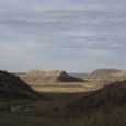
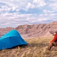
| Deer Haven is a solitary plateau near Conata Basin in the Badlands. |
In South Dakota you can social distance outside. There's no Times Square out there. And the distances are greater.
Inside may be safer but it can become a prison, a dungeon with a tiny window installed by Apple or Samsung. That window is where you find us, and we are rowdy house guests.
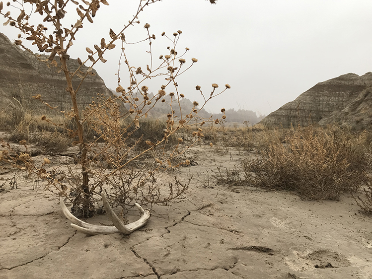
And South Dakota is home to the badlands. The Badlands. There is no place as unconfined.
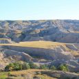
The Conata Basin is a grassy bay between the main Badlands wall and an intersecting ridgeline that branches south and east. By night, black-footed ferrets, back from near-extinction, hunt prairie dogs. So do rattlesnakes, owls, fox and coyote. At the Conata Picnic Area, you can park and hike around in the basin or up into the high country.
From here, there are drainages that track northeasterly into a narrow canyon where you can climb to the very edge of the wall and peep at the Badlands loop road snaking through the Yellow Mounds below. Climb down to explore an off-road world, seldom-seen, car-free.
At the end of the little cul-de-sac in the Conata Picnic Area, there's a sign with a blurb about a place called Deer Haven, a juniper forest plateau along the ridgeline above Conata Basin.
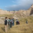
There is no marked trail. The easiest way to get there is to walk southeast, then east along the edge of the ridgeline. You'll find a well-worn game/human path that peters out at a cut in a dome formation. As soon as you round this dome and face north, Deer Haven is spread out before you.
There are many deer trails through a patch of thick brush, and at least one doable pass up onto the plateau. As a public service announcement, I should mention that as with much off-trail — and some on-trail — Badlands exploration, making this ascent involves some hands-and-feet scrambling. Please proceed with caution and know that you can also access beautiful views from the low country.
As you walk towards Deer Haven, you'll notice a distinctive hole that could be a portal to another dimension high along the ridgeline to the west.
Archaeologist Linea Sundstrom has written about what she calls a "cross-cultural transference of the sacred geography" in regards to the Black Hills, meaning that beliefs in the sacral nature of particular places were transferred among different groups of people over time. I'm not an archaeologist but I do believe that's a fine way of thinking — not that you have to appropriate other peoples' cultures, but that I can accept that a place you say is sacred is sacred, and then perceive it as such, in a consecrated manner. We can extend this even to deer, who clearly sacralized this place before somebody at the National Park Service thought of putting up a sign in the cul-de-sac. If you go, you'll understand.
Michael Zimny is a content producer for South Dakota Public Broadcasting and is based in Rapid City. He blogs for SDPB and contributes columns to the South Dakota Magazine website.

$29 for 1 Year |
 |

Comments