

The Gift of South Dakota
Subscriptions to South Dakota Magazine make great gifts!
Subscribe today — 1 year (6 issues) is just $29!
Social Distancing in the Wild
Apr 22, 2020
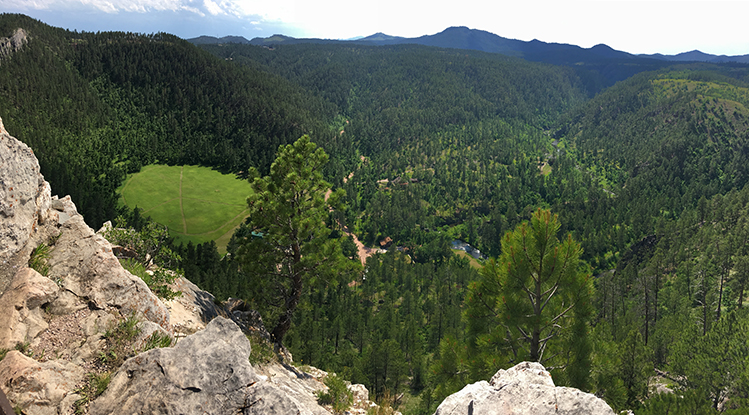 |
| The Stratobowl Trail overlooks the green meadow where scientists launched record-breaking balloon flights in 1934 and 1935. |
The coronavirus has upended lives around the world. Our routines as we knew them just a few short weeks ago no longer exist. Many of us, including the South Dakota Magazine staff, are working from home. Businesses are shuttered, gatherings of more than 10 people are forbidden and — in the event that folks do need to leave their houses — a 6-foot buffer between humans at the very least must be maintained, all in an effort to slow the spread of the deadly virus.
One refrain that keeps popping up, though, is that the outdoors are never closed. We try to take a walk around Yankton every day that the weather allows (and we all know that the transition from winter to spring in South Dakota can be wildly unpredictable). The movement and fresh air do wonders for both our physical and mental health. With that in mind, here are three favorite hiking trails that I’ve discovered while on the road. Later, in our July/August issue, we’ll have even more ways you can safely enjoy the outdoors in South Dakota during what is shaping up to be an unprecedented summer.
Stay safe and healthy by exploring these or other trails near you.
Stratobowl Trail
It’s a short and easy hike from busy Highway 16 to the spot where scientists made history in 1935. The Stratobowl Rim Trail begins on a gravel maintenance route about 2 miles west of Bear Country USA (look for a closed gate and maybe a parked car or two). The path is wide and well maintained, but there are plenty of large rocks along the way, so be sure to have sturdy footwear.
Nearly every step of the 0.8-mile trail follows the well-worn road, through the tall pine trees of the Black Hills National Forest. The trail branches off to the left near the end, and a narrower path leads to four granite slabs that tell the story of the Stratobowl balloon launches of 1934 and 1935 that sought to collect information about the upper reaches of the Earth’s atmosphere. During the second launch, scientists floated more than 72,000 feet into the stratosphere, higher than any human had previously traveled.
An overlook tucked among the limestone cliffs provides a panoramic view of the Black Hills and the bowl below. Plan about an hour for the out and back hike.
Alkali Trail
This short and family-friendly trail takes hikers through a variety of Black Hills landscapes: a creek valley, ponderosa pine forests and prairie meadows, all in the shadow of Bear Butte.
From Interstate 90, take exit 34. Follow a gravel road toward Sturgis known locally as the Old Stone Road or the Fort Meade Backcountry Byway. Around a bend the road crosses Alkali Creek. After another few hundred feet, you’ll find the gravesite of Black Hills outlaw Curley Grimes. Across the road is a small campground and access to the Alkali Trail.
Grab a brochure at the trailhead and follow along to each of 10 marked posts along the path. Starting at the creek and progressing through the woods, into a clearing and back, each stop provides a natural history lesson — Native Americans used the green ash trees to fashion poles, bows and arrows; rocks covered with lichens are slowly decomposing into soil; patches of snowberry provide excellent winter cover for deer.
The Alkali Trail is slightly more than half a mile long. Allow about 45 minutes for a leisurely hike.
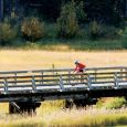
Gavins Point Nature Trail
The Gavins Point Nature Trail is a family-friendly path within the Lewis and Clark Recreation Area, about 9 miles west of Yankton. A kiosk at the trailhead offers brochures that explain the types of trees and insects found in the forest. Kids can use them as a scavenger hunt guide as they traverse the 1.2-mile dirt path. They’ll have fun identifying the Eastern red cedars, bur oaks and old cottonwoods that grow thick along the Missouri River bluffs, and the millipedes and spiders that crawl around the undergrowth.
Adults will appreciate the exercise. Two wooden bridges, a set of stairs and several inclines account for the trail’s moderate rating. About halfway through, hikers are rewarded with a magnificent view of the shimmering water and chalkstone bluffs of Lewis and Clark Lake.


Comments