The Gift of South Dakota
Subscriptions to South Dakota Magazine make great gifts!
Subscribe today — 1 year (6 issues) is just $29!
On the Quartzite Trail
There’s a geologic treasure in southeastern South Dakota that has been here longer than our famed petrified forests or the prehistoric fossils painstakingly brushed from the soil. Outcroppings of ultra-hard, 1.6-billion-year-old Sioux quartzite protrude from grassy prairies and riverbanks over 6,000 square miles from the James River eastward into Minnesota and Iowa.
 |
| Jim Kersten |
People have placed significance upon the unique pink rocks for centuries, but Jim Kersten believes that what he calls “quartzite country” holds even more potential. He’s spent years creating the Sioux Quartzite Outcrop Trail that takes people to 10 primary sites, nine secondary locations and over two dozen historical attractions in South Dakota, Minnesota and Iowa that feature quartzite naturally or architecturally.
Kersten became interested in quartzite while operating a bed and breakfast in Alcester from 1995 to 2005. He often hosted kayaking ventures along the Big Sioux River and bicycle tours through southeastern South Dakota. Quartzite was right under his nose, though he never thought of the region as a destination until he served on the Big Sioux Recreation Council. “I ended up being the historian because I liked it,” says Kersten, who today runs a painting business with his twin brother in Aberdeen. “I decided to inventory some sites along the river from Dell Rapids to Sioux City. I found that a lot of my sites along the river were quartzite sites. I finally figured out that was the common denominator, especially in areas where outcroppings go across the river. I could develop a lot of themes, but the quartzite was the key.”
Quartzite is easily the oldest feature in eastern South Dakota, and it confounded early European visitors like artist George Catlin and explorer Joseph Nicollet, both of whom visited pipestone quarries in the 1830s. “The single fact of such a table of quartz, in horizontal strata, resting on this elevated plateau, is of itself a very interesting subject for investigation; and one which calls upon the scientific world for a correct theory with regard to this time when and the manner in which this formation was produced,” Catlin wrote.
Kersten says Nicollet and others offered a variety of scenarios to explain quartzite’s origin, including one with Biblical origins. But they had not heard the theory of Swiss geographer Louis Agassiz, who in 1837 became the first scientist to propose that Earth had endured an Ice Age, in which he argued that rocks — including Sioux quartzite — were shaped, transplanted and uncovered by huge, slowly-advancing glaciers.
Today’s impressive river formations began as fine grains of quartz no bigger than half a millimeter. They were deposited on the bottom of a shallow sea that once covered large portions of North America. The particles, rounded by water and compacted by heat and intense pressure, slowly built and hardened over millions of years. Then glaciers swept across the continent, revealing what Kersten considers, “the Black Hills of East River.” “The Black Hills are gorgeous, but there’s little rock in the Black Hills as old as this,” he says. “This is as old as rock in the bottom of the Grand Canyon, and there you’re looking at 1.7 billion years of strata going down.”
Kersten’s “Quartzite Country” extends from Redstone, at the junction of the Cottonwood and Minnesota rivers in Minnesota, and runs to the James River near Mitchell. Exposed stone is found between Flandreau and Canton, but quartzite has been discovered during well digging as far west as Stanley and Jones counties in South Dakota, and across the Missouri River into northern Nebraska.
His tour of 10 primary quartzite sites — selected because of the significant outcroppings or association with Indian history — begins in Sioux Falls. The trail loops 370 miles through eastern South Dakota and western Minnesota, and ends at the Dells of the Big Sioux River near Dell Rapids. “The whole picture is bigger than its parts,” he says. “Each one of these sites has its own story, and it’s about much more than the rocks. Prairie is being restored at a number of places, including all the primary outcroppings.”
Take time this summer to explore the Sioux Quartzite Outcrop Trail and see the unique role prehistoric rocks have played in developing the frontier.
Queen Bee Mill & Falls Park, Sioux Falls
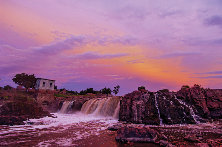 |
| Queen Bee Mill and Falls Park. Photo by Greg Latza |
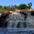
Sioux Falls town builders were awed by the powerful torrents of water cascading over the quartzite boulders that comprise the falls of the Big Sioux River. About 7,400 gallons of water drop 100 feet over the course of the falls every second. Richard Pettigrew, a city father, politician and businessman, sought to harness that power in 1878 when he began construction on the seven-story, state-of-the-art Queen Bee Mill.
The new mill was capable of producing 1,200 barrels of flour a day. But soon after it opened in 1881, investors realized that Dakota farmers couldn’t produce enough wheat to keep the mill solvent. By 1883, it was closed.
Entrepreneurs tried various businesses in the old quartzite mill, but each venture failed. The structure became a warehouse in 1929, and much of it was destroyed by fire in 1959. Its upper floors were demolished after the blaze for safety. Its ruins still stand on the riverbank.
Today the city of Sioux Falls has transformed the 123-acre Falls Park into a popular destination for families with a cafe, picnic space and trail system.
Mary Jo Wegner Arboretum and East Sioux Falls Historic Site, Sioux Falls
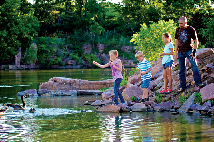 |
| Arrowhead Park, East Sioux Falls. Photo by Christian Begeman |
Construction is finishing on the Mary Jo Wegner Arboretum and East Sioux Falls Historic Site at the junction of Highways 11 and 42. Sioux Falls’ newest park is the brainchild of Mary Jo Wegner, a local environmental advocate who envisioned a natural haven of gardens, plants and wetlands as an escape from the urbanity of South Dakota’s largest city. When completed, the area will include six gardens, interpretive exhibits and an extension of the Sioux Falls Bike Trail.
The 115-acre park sits on land rich in quartzite history. East Sioux Falls was once a thriving community of 600 residents, many of whom relied on local quartzite quarries for their livelihoods. A number of quarries were operating in Sioux Falls by the end of the 1880s, but the largest opened at East Sioux Falls in 1887. By 1890, nearly 500 men toiled there, cutting stone to ship via rail to cities like Omaha, St. Louis and Chicago for street paving.
An economic downturn in 1891 followed by the Panic of 1893 slowed production at the Sioux Falls quarries. As concrete became the building material of choice, workers began to leave East Sioux Falls. The city gave up its charter in 1913.
Jasper Pool, Gitchie Manitou State Preserve, South Dakota/Iowa Border
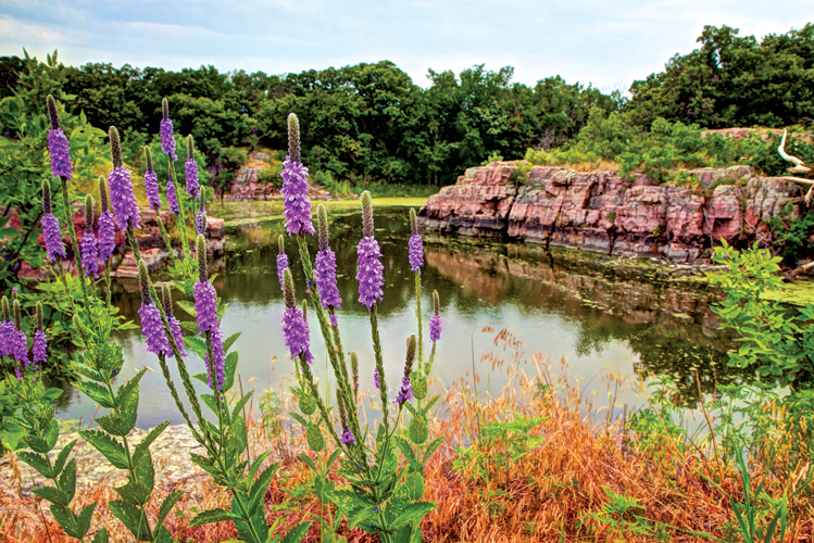 |
| Jasper Pool. Photo by Christian Begeman |
Just across the Big Sioux River in Lyon County, Iowa, the oldest exposed bedrock in that state is preserved at Gitchie Manitou State Preserve. From the 1890s to 1920, a quartzite quarry operated in the northeast corner of the 91-acre preserve. The remains have filled with water, creating the Jasper Pool.
Another feature of Gitchie Manitou is a series of conical mounds near its southern edge. Archaeologists are still determining their significance, but they may be part of a larger complex found at Blood Run, South Dakota’s newest state park along the South Dakota/Iowa border that was home to the Oneota people for 8,500 years.
Queen Rock, Palisades State Park, Garretson
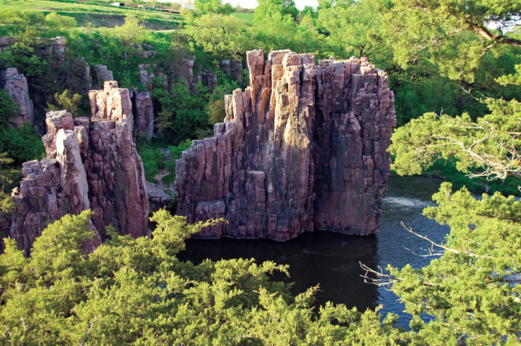 |
| King and Queen Rock, Palisades State Park. |
South of Garretson, quartzite cliffs and rock formations rise 50 to 60 feet along the banks of Split Rock Creek. Among the most unique formations are two spires called King and Queen Rock.
At just over 150 acres, Palisades is South Dakota’s second smallest state park. Still, it boasts a campground, a lodge and four hiking trails, including the King and Queen Rock Trail. The 0.2-mile route passes the King and Queen and the rest of the park’s most impressive quartzite formations. The trail also winds past the site of Palisades, a small town formed in 1870 after homesteaders built a large flourmill along the creek. But A.S. Garretson, an entrepreneur from Sioux City, made sure a railroad junction was placed two miles north on land he owned, spawning the town named for him and facilitating Palisades’ demise.
Adventurers come to Palisades for kayaking and rock climbing, which poses special challenges. The surface of the quartzite ranges from gritty to slippery smooth, the result of glacial weathering.
Devil’s Falls, Devil’s Gulch Park, Garretson
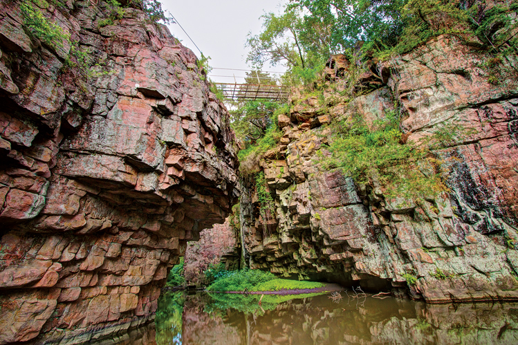 |
| Devil's Gulch. Photo by Christian Begeman |
Outlaws Frank and Jesse James robbed a bank in Northfield, Minn., in 1876 and rode west. Legend says that as they eluded a posse, Jesse spurred his horse and jumped a 20-foot chasm across Split Rock Creek on the edge of Garretson.
If it’s true, Jesse probably didn’t have time to appreciate the quartzite-lined gulch or the nearby waterfall. Some geologists speculate that an ancient earthquake split the quartzite and created the fissure. Today an iron footbridge spans the gap where Jesse is said to have leapt. A hiking trail leads to the falls and other quartzite features, such as Devil’s Kitchen and Devil’s Stairway.
Touch the Sky Prairie, Rock County, Minnesota
Here the trail turns east into Minnesota and stops near Luverne at Touch the Sky Prairie, site of a major prairie restoration project. The U.S. Fish and Wildlife Service and the Brandenburg Prairie Foundation, led by local photographer and filmmaker Jim Brandenburg, have purchased 1,000 acres of land northwest of Luverne. Fences and old farmstead buildings have been removed to make room for native plants and animals. The acreage also features a mile-long quartzite ridgeline that served as a buffalo rub. Some of the outcroppings have surfaces as smooth as glass, the result of centuries of rubbing.
Blue Mound State Park, Luverne, Minnesota
Homesteaders traveling west across the prairie noticed a strange mound with a blue tint as they neared South Dakota. They soon discovered the “blue mound” was a 100-foot tall outcropping of Sioux quartzite, one of many at Blue Mound State Park, an 1,800-acre oasis of prairie grasses and flowers north of Luverne.
Local historians believe Plains Indians first utilized the mound as a buffalo jump because of the large number of bones recovered at the outcropping’s base.
Pipestone National Monument, Pipestone, Minnesota
The pipestone quarries near Pipestone, Minn., just across the state line east of Flandreau, have been sacred to Plains Indians for centuries. A Brule legend told by Lame Deer in the 1960s relates their importance in the creation of the Lakota people. It began with a flood that inundated all the land except a hill next to the sacred quarries. People clamored to the hilltop, but rising waters killed everyone except a young girl saved by a bald eagle that flew her to safety in the Black Hills. The Lakota people were descended from that union. Meanwhile, the blood of the flood victims turned to pipestone and created the vast quarries.
Indians have journeyed to the quarries for at least 800 years to extract pipestone from the layers of Sioux quartzite that jut from the Earth at the Pipestone National Monument. The monument was created in 1937 to ensure Indians of all federally recognized tribes had access to pipestone, used in making ceremonial pipes. A feature of the monument is a quartzite outcropping that forms a 10- to 15-foot cliff line that runs north to south along the entire length of the 301-acre site.
Jeffers Petroglyphs, Comfrey, Minnesota
Flat slabs of quartzite dot the prairie at the Jeffers Petroglyphs Historic Site near Comfrey, Minn. Here, Plains Indians — including the Lakota and Dakota — scratched over 4,000 images into the hard stone. The oldest drawings could be 9,000 years old, while the newest were done within the last two centuries. They tell of important events, sacred ceremonies, legends and stories of hunting and other daily activities. The age of the drawings indicates that Jeffers is among the oldest continually used sacred sites in the world.
Dells of the Big Sioux, Dell Rapids
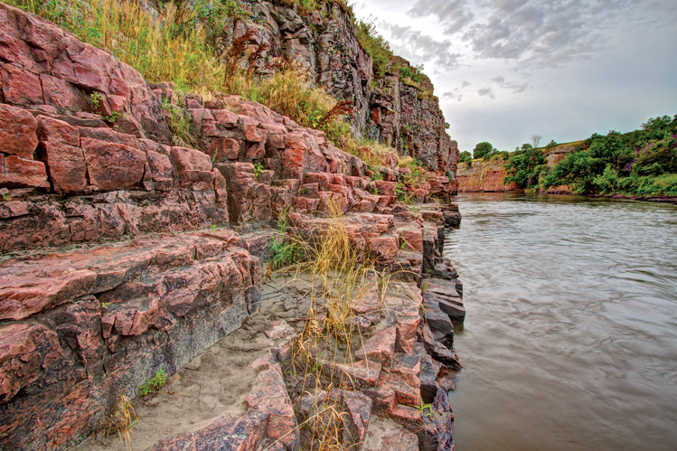 |
| Little Dells. Photo by Christian Begeman |
The trail concludes at the Dells of the Big Sioux River, south of Dell Rapids in Minnehaha County. Quartzite was key to Dell Rapids’ development. Many of the 39 buildings in the downtown business district were constructed using locally quarried quartzite. Even the high school mascot is a “quarrier.”
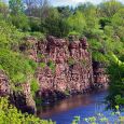
At the peaceful dells, the river flows between 40-foot quartzite walls sprinkled with lush trees and prairie grasses.
Along the Way ...
Kersten has identified nine secondary outcroppings along his quartzite trail. The first is Arrowhead Park in Sioux Falls. The 131-acre park features two quarry ponds that were once part of the bustling East Sioux Falls quarry scene. Dale Weir donated the land to the city of Sioux Falls for development as a park. Ducks and geese frequent the ponds, which are connected by a walking trail that also passes an 1888 barn designed by Sioux Falls architect Wallace Dow.
At Split Rock Creek City Park in Garretson, and Split Rock Creek State Park in Ihlen, Minn., quartzite walls tower over the placid stream. Kayakers enjoy paddling the stretch through the Garretson park, which includes a dam, bridges, a rock wall and a bathhouse built in 1936 as a Works Progress Administration project. All the structures are made of quartzite.
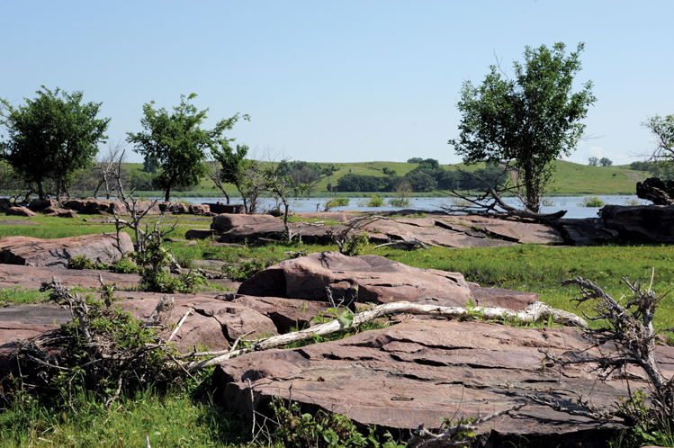 |
| Rockport Hutterite Colony. |
The Red Rock Falls and Red Rock Dells in Cottonwood County, Minn., feature more quartzite outcroppings. A 0.34-mile trail skirts the edge of some boulders and through a gorge to the small waterfall. Keep heading east toward Redstone, the eastern edge of quartzite county near New Ulm, Minn. An active quarry on the eastern edge of town has been operational since 1861.
Kersten’s trail re-enters South Dakota at the Three Sisters quartzite formation in the Big Sioux River near Dell Rapids and two sites of early construction: the Dell Rapids Mill and Saint Olaf Roller Mill and Power Dam in Baltic. “There are 20 mills in a pretty tight radius of Sioux Falls,” Kersten says. “Every town had a mill. My next project could be on the grist mills of southeastern South Dakota.”
The final stop is Rockport Hutterite Colony along the James River south of Alexandria. It marks the western edge of significantly exposed quartzite. Huge slabs lie between the colony buildings and the lazy river, along with quartzite foundations of buildings that comprised Fort James, built in 1865 to maintain peace between homesteaders and Indians. Soldiers occupied Fort James — one of the only stone cavalry forts in the West — for a year before it closed in 1866.
Editor’s Note: This story is revised from the September/October 2013 issue of South Dakota Magazine. To order a copy or to subscribe, call (800) 456-5117.





Comments